The popular demand for drones, since being commercialized in the mid-2000s, has led to an increase in interesting use cases. From aerial photography to complex search and rescue missions, drones have become crucial for businesses and hobbyists around the world. The research and development of mobile LiDAR, alongside drones, has provided opportunities to map previously unobtainable or hard-to-reach areas.
This blog explores why a drone equipped with LiDAR is useful and who uses it around the world.
What is a LiDAR drone?
A LiDAR drone is any aerial drone system with a LiDAR sensor mounted to it. Used for scanning large external areas or enclosed spaces, they make collecting accurate data easier and more accessible.
What is a drone?
Drones are aircraft that are either remotely controlled on the ground or autonomously flown using internal software. Used for a series of different applications including monitoring changing environments and in search operations after natural disasters, drones make scanning large areas easier and seamless.
From a professional viewpoint, a drone is a fantastic and irreplaceable tool providing businesses with innovative ways to conduct day-to-day activities. Smaller drones might be utilized for creating imagery for marketing and larger drones for mapping. On the other hand, drones are great for people pursuing a new hobby, for capturing video footage from the air or racing them.
What is LiDAR?
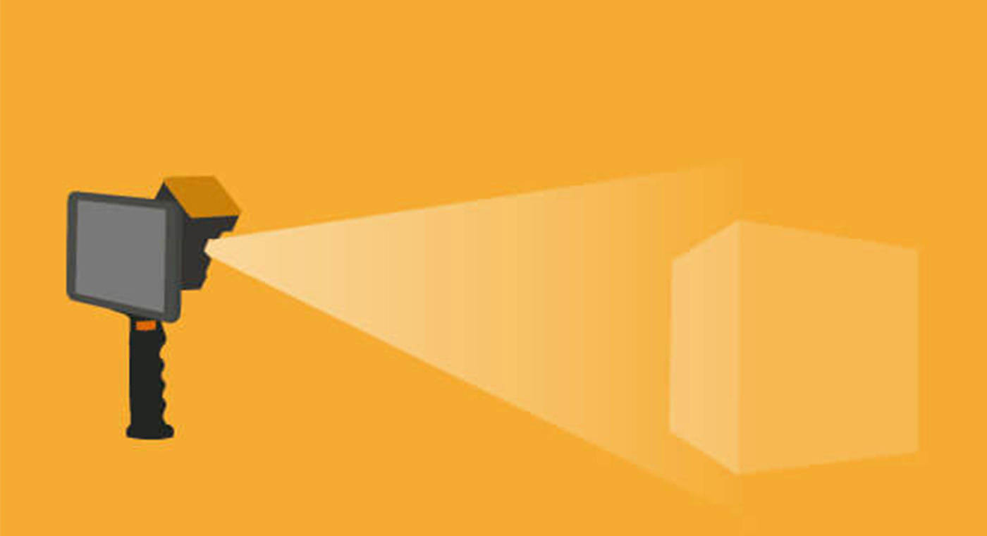
LiDAR stands for Light Detection and Ranging and is a method of remote sensing that creates digital 3D replicas of the real world. Similar to radar, it sends a pulse which is reflected back to the sensor when it bounces off a surface. Ideal for surveying large areas accurately, LiDAR has been a constant in surveyors' toolkits since the 1980s.
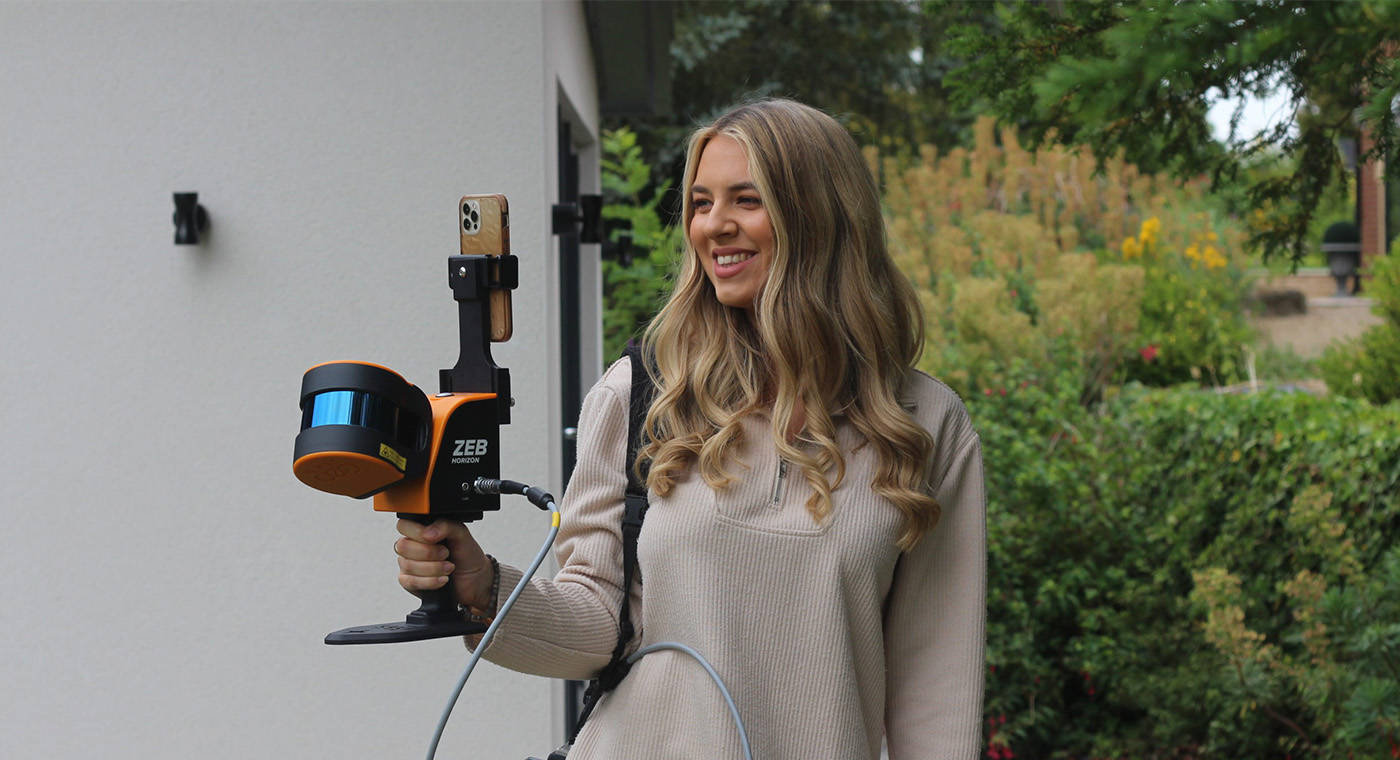
Originally in the form of a Terrestrial Laser Scanner (TLS), an accurate static-based solution, LiDAR sensors have developed into more versatile tools in recent years. SLAM technology has made this possible, and we're now at a point where LiDAR sensors can map handheld, on vehicles, or via drone.
What is SLAM?
Simultaneous Localization and Mapping, more aptly named SLAM, is a way of mapping an area whilst keeping track of the location a device is in. SLAM systems simplify data capture, providing a way to map underground, overground, or seamlessly transition between the two. Moreover, SLAM does not require access to satellites, so is the ideal solution for indoor and underground environments.
The development of SLAM is a huge step forward for LiDAR and makes mapping hard-to-reach places or harsh environments, like mines or caves, possible.
How does a LiDAR drone work?
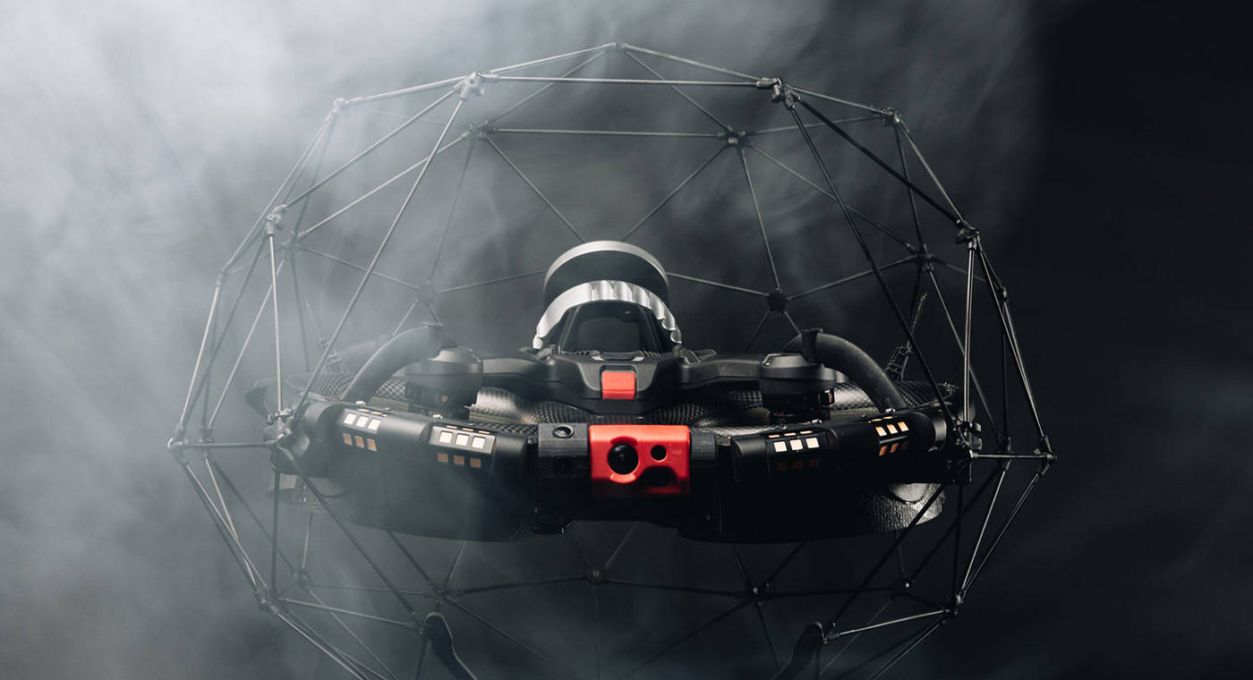
A LiDAR drone works by mounting a LiDAR sensor to a drone, either by attaching a handheld LiDAR device or making it a permanent feature of the drone, like Flyability's Elios 3.
What is LiDAR drone surveying?
Using a LiDAR drone to map a site allows surveyors to capture inaccessible environments or features easily and safely from the ground. Those in need of fast, repeatable surveys of either hard-to-reach or vast areas should look no further than drone LiDAR. Applications include:
- Mining: Ideal for capturing unforgiving environments to provide surveyors with a comprehensive view of progress.
- AEC: Provides a way to repeatedly capture construction sites from the sky, without impeding day-to-day work, to track change over time.
- Forestry: Capturing forests with dense canopies to provide an accurate overview of deforestation or carbon measurements.
- Heritage: Documenting historical sites and monuments from the sky, using less invasive capture techniques.
- Disaster management: Working at all stages of the disaster management cycle, whether that's mapping the damage caused in a nuclear disaster or understanding an impacted area for search and rescue.
- Utilities: Useful for repeat safe scans of utilities like powerlines, to report changes in the environment around the utilities, over time.
What is the difference between LiDAR and photogrammetry?
During the photogrammetry process, a drone captures many images over the mapped environment. The images overlap so that every point on the ground is observable from multiple angles and viewpoints. This provides the necessary details to create a 3D model, which includes information on the elevation and shape. Unlike LiDAR, photogrammetry isn't as accurate, however, it can provide a greater visual of an area through color.
LiDAR sensors emit pulses of light that measure the time it takes to bounce off an object and return to the sensor. LiDAR is useful in a range of environments and spaces as it can capture data that may be difficult for other methods of scanning, such as areas with dense vegetation. In these situations, the laser penetrates spaces between the foliage and can map the ground below.
Both methods are useful, depending on a user's required output, and in some cases, a LiDAR drone with photogrammetry can be used to provide a more complete, colored point cloud.
Who uses drone LiDAR?
As pointed out above, drone LiDAR is an ideal solution for many industries, and for various reasons, but here are a few use cases:
Shamrock+
Shamrock+ is a US-based company that provides creative and visual solutions to individuals and businesses through photography and 3D data collection services. Previous users of static-based systems, Shamrock+ acquired a handheld LiDAR scanner for data acquisition and to mount to their Freefly drone. This versatility has opened the possibilities of capturing large areas on foot, vehicles, and by air, using the same scanner.
Visualskies
Visualskies specialize in volumetric capture, processing, and content, as well as being experts in 3D/4D scanning technologies. A globally recognized company, they've traveled to countries all over the world to scan anything from ancient forests to lost cities. Working closely with National Geographic for their Lost Cities series, Visualskies unearthed a lost city covered by thick jungle in Micronesia. Scans were conducted from the sky using the DJI M600 with a handheld laser scanner mounted underneath the drone.
CPE Tecnologia
When the need for renovations on Brazil's famous Christ the Redeemer monument became clear, CPE Tecnologia was on hand to 3D map the monument. The versatility of handheld laser scanners meant that the team was able to conclusively capture the interior of the monument on foot and the full exterior using the DJI M600 and drone mount.
InspecDrone
Data capture using LiDAR drone isn't restricted to wide open spaces though, it's also useful in tightly enclosed spaces. InspecDrone's (a German-based drone expert inspection company) services were required when Refretechnik Cement in Harburg needed a 3D model of their plant and assets. Utilizing Flyability's Elios 3, InspecDrone could map the plant and assets safely and quickly. Furthermore, it's a highly repeatable process, allowing for the reviewing of change.
Our tips for getting the best out of your LiDAR drone scansThere are a few things to keep in mind when mapping with a LiDAR drone, to make the process easier.
Scanning at range
Though a drone doesn't need to fly close to the ground for the LiDAR to capture accurate data, lower altitude flying results in a high point cloud density.
Georeferencing
Though SLAM doesn't require GPS to operate, for those in need of georeferenced data, reflective targets are an ideal solution.
Flight patterns
Not all flight patterns are the same. In fact, depending on the terrain and mission, you can deploy different patterns. These might include grid, round, or comb.
- Grid: Ideal for capturing large areas, ensuring coverage.
- Round: Great for mapping monuments or buildings, circling around objects.
- Comb: Used for ensuring good coverage in an irregular environment and ensuring loop closure.
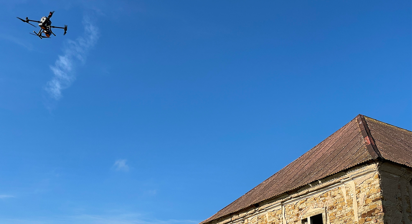
What drones can the ZEB Horizon be mounted to?
GeoSLAM offers users the ability to capture ZEB Horizon data from the skies with drone mount accessories available for specialist drones. These include:
DJI M300
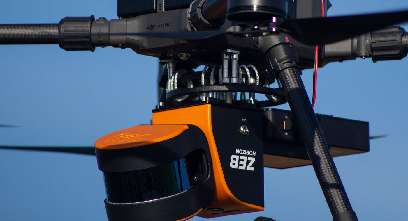
The Matrice 300 is DJI's latest commercial drone that offers 55 minutes of flight time, advanced AI capabilities, six directional sensing and more. It excels standards by combining intelligence and advanced performance with reliability. The M300 can hold up to three payloads simultaneously with a maximum payload capacity of 2.7kg.
GeoSLAM offers a mount for the DJI M300, to mount the ZEB Horizon. The mount comes with its own datalogger that powers directly from the drone, making the payload lighter.
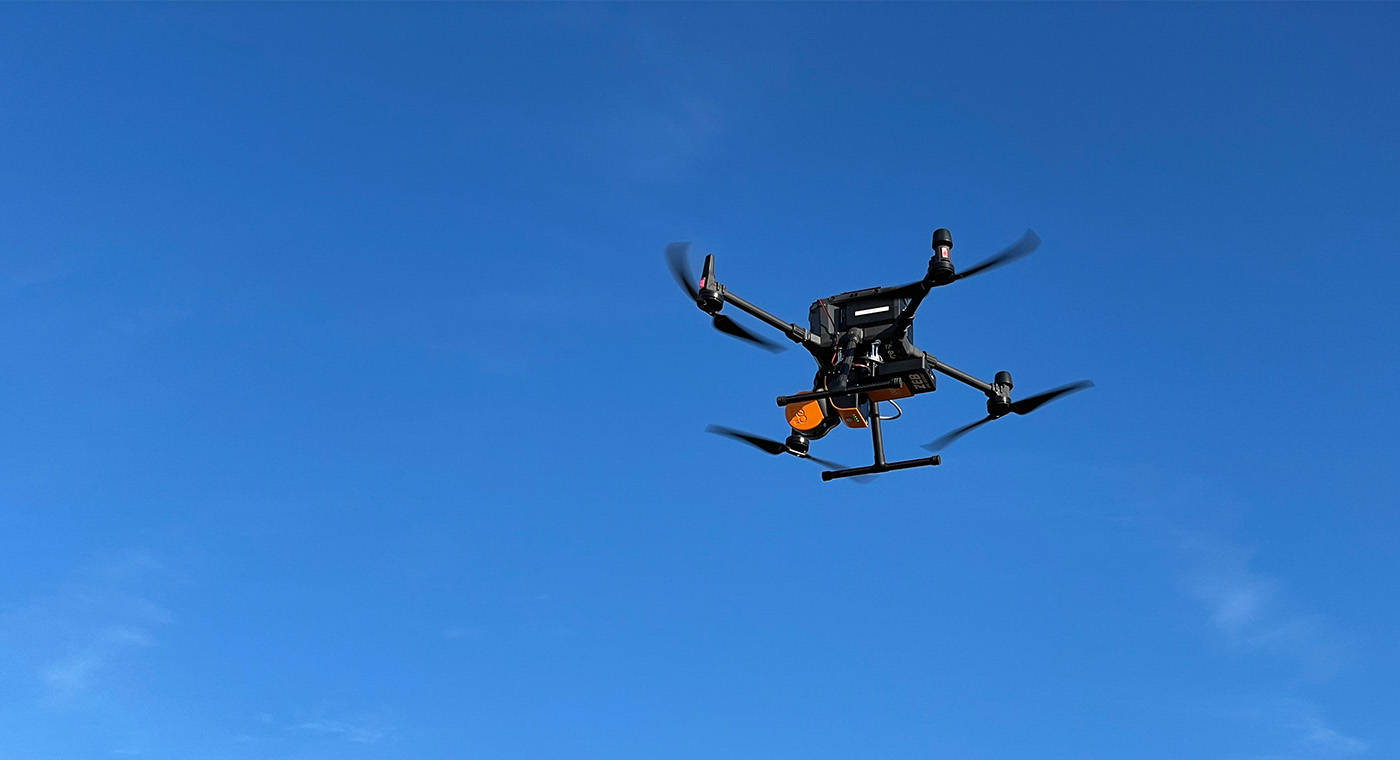
Freefly Alta 8, 8 Pro and X
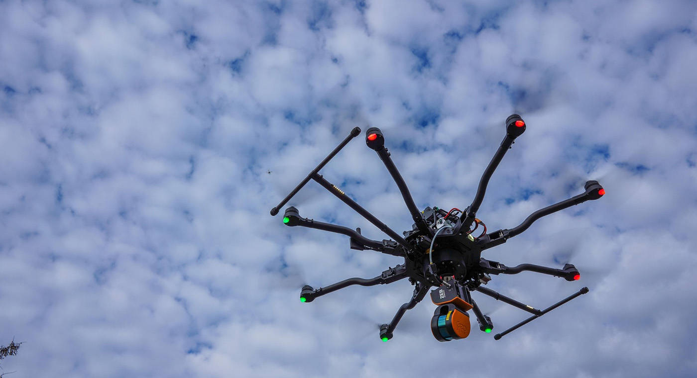
Designed to benefit professional and industrial partners, Freefly's state-of-the-art drones are suitable for a variety of solutions. The Alta X, for instance, can carry and fly payloads of up to 35lb and its flight time ranges from 10 to 50 minutes depending on the additional weight it is holding.
The ZEB Horizon can go from handheld to flying in minutes with GeoSLAM's UAV mounts, which include a mount for the Alta X.
Flyability
Through GeoSLAM's partnership with drone specialist company Flyability, it is possible to turn Elios 3 LiDAR data into survey-grade 3D models using GeoSLAM Connect. The Elios 3 allows users to access and survey hard-to-reach and hazardous spaces due to its collision-tolerant design. This integration increases efficiency and productivity by streamlining data collection and processing time.