宣传册

Traceable Construction: FARO’s ecosystem for an informed construction lifecycle

traceable-construction-brochure
Whilst many think of BIM as a 3D model of a building, it’s better to think of it as the process of ‘Building an Information Model’ or dataset that is used from project conception, through to operation, reuse and demolition.

Typically, this information will be delivered as documents, graphical models and non-graphical information. The combined project dataset will be formed of information contributions by a range of designers, builders, product manufacturers, asset operators and facility managers along the way and will increase in its ‘completeness’ throughout the asset’s life as a virtual representation of it.

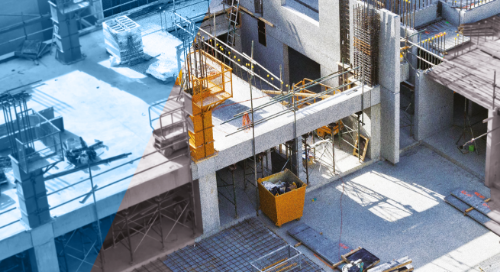
This publication looks at FARO®’s contribution to this wider process at numerous stages through the introduction of their ‘Traceable Construction’ concept. It is the ecosystem of products and solutions that FARO offers to leverage the benefits of measured data throughout the various stages.
宣传册
建筑、工程和建造
完工数据捕捉与建模
施工预制
施工质量控制
设计布局与投影
用于资产与设备管理的数字孪生平台
文物保护
建筑、工程和建造
三维扫描仪
激光投影仪
软件 - 建筑、工程和建造
Focus
Tracer
As-Built
BuildIT Construction
SCENE
WebShare
建筑与建造
意识

订阅我们的时事通讯以了解最新信息。

相关内容

筛选

筛选

CASE STUDY

How a German Heavy Transport Manufacturer Uses 3D Scanning

Discover how Germany’s Scheuerle Fahrzeugfabrik, a heavy-load transportation specialist, employs both the FARO® Focus Laser Scanner and Vantage Laser Tracker to aid in its assembly workflows.
VIDEO

Wie Pratt Miller 3D-Technologie zur Verbesserung der Fahrzeugentwicklung einsetzt

Erfahren Sie, wie Pratt Miller den handgeführten Scanner FARO Leap ST als hochmodernes Werkzeug für detailliertes Design, Tests und Iterationen der Fahrzeugmontage verwendet.
ARTICLE

Understanding Handheld 3D Scanning and Smart Manufacturing

The smart factory of today and current iterations of handheld scanning are inseparable companion tools. Learn how the FARO Leap ST is helping lead the way.
ARTICLE

GD&T for beginners: MMC & bonus tolerance, explained in 3D

Visualization challenges in 2D and 3D documentation for geometric dimensioning and tolerancing and the scanning and probing tools needed to measure hard to reach locations.