Papel branco

Surveying basics

Surveying basics

WHITEPAPER:
Surveying, as defined by the American Congress on Surveying and Mapping (ACSM), is the science and art of making all essential measurements to determine the relative position of points or physical and cultural details above, on, or beneath the surface of the Earth, and to depict them in a usable form, or to establish the position of points or details.

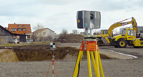
Through the years, a number of different measurement methods have been used to collect this data. However, as the need for more accurate measurements has evolved, advanced 3D technology has become available to meet existing needs, and provide comprehensive documentation that was not previously possible through traditional methods.
 

Papel branco
Arquitetura, engenharia e construção
Coleta e modelagem do As-Built
Arquitetura, engenharia e construção
Scanners 3D
Focus
Levantamento e medição
Conhecimento

Assine nosso boletim informativo para manter-se informado.

Conteúdo relacionado

Filtros

Filtros

VIDEO

Regal Marine Makes Waves with the FARO® Leap ST® 3D Scanner

Discover how Regal Marine is transforming boat manufacture by integrating the Leap ST Handheld Scanner into its workflow to enhance quality and efficiency.
VIDEO

Glorious Success: Restoration of the B25 “Sandbar Mitchell” with a FARO Assist

Learn how Michigan’s The Warbirds of Glory Museum uses the FARO® Leap ST to help restore a famous B25 aircraft nicknamed “Sandbar Mitchell.”
CASE STUDY

How a German Heavy Transport Manufacturer Uses 3D Scanning

Discover how Germany’s Scheuerle Fahrzeugfabrik, a heavy-load transportation specialist, employs both the FARO® Focus Laser Scanner and Vantage Laser Tracker to aid in its assembly workflows.
ARTICLE

Understanding Handheld 3D Scanning and Smart Manufacturing

The smart factory of today and current iterations of handheld scanning are inseparable companion tools. Learn how the FARO Leap ST is helping lead the way.