Choate Construction
Hurricane Irma was the most powerful storm to hit the continental United States since Katrina in 2005. The financial cost to property was estimated to top $50 billion — the fifth costliest hurricane in US history.
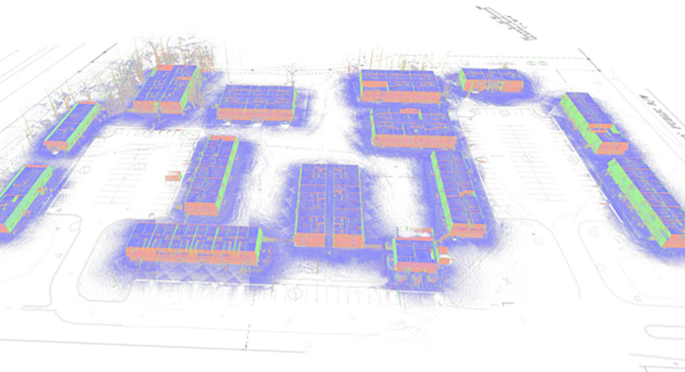
Among the damaged properties was the Westlake Apartments in Savannah, Georgia — a complex of 14 buildings containing 100 individual apartments encompassing over 111,000 sq. ft. These residential structures were flooded by the storm surge, meaning major renovations were required to repair the significant water damage.
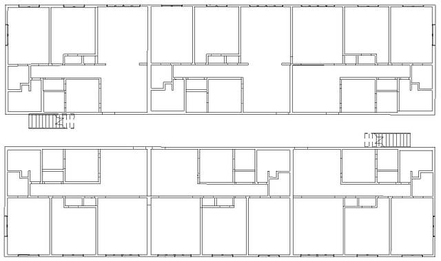
With the construction of the complex dating back to 1974, no up-to-date building blueprints were in existence. The huge task facing contractor Choate Construction was therefore to rapidly collect spatial data to produce the necessary internal floorplans and external elevations. Speed was an absolute priority, ruling our traditional forms of data capture.
Therefore, mobile LiDAR was the ideal solution, due to its speed of capture and ease of use. Just 14 scans took place (one scan per building) to collect the necessary elements (floors, walls, ceilings, roofs, doors and windows) within the required accuracy tolerance.
The average scan time was 40 minutes per building and in total the team spent less than 10 hours scanning — just 2 days on-site.
This speed was of particular importance as the residential units were in occupation. With a scan time of just five minutes per unit, disruption to residents was kept to an absolute minimum.
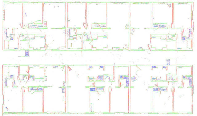
The survey team was delighted with the high reliability of the scan data, all within 1” relative and absolute accuracy. They were also surprised by how well the external features (exterior walls and sloped roofs) captured — with no drift or errors encountered.
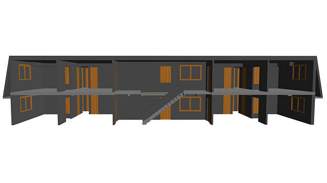
The office team was able to view the individual 3D point clouds, as well as merge them into one. The data was sliced into plans, sections, and elevations before being exported in a CAD-friendly format. From this data, they created an accurate 3D Autodesk® Revit® model and supplied it to the project architect.