Delivering accurate representations of built environments
Shamrock+, based in Savannah Georgia, provides creative and visual solutions to individuals and businesses through photography and 3D data collection services. Using UAVs, cameras, sensors and software, Shamrock+ delivers accurate representations of built environments for its clients.
They largely work in Architecture, Engineering and Construction (AEC) however, they also assist professionals with projects in the Real Estate sector. Their solutions include photography, progress documentation, creating 3D data visualizations and as-built.
Shamrock+ originally already uses static-based solutions to produce 3D point clouds. Though highly accurate, they needed an additional solution for collecting data that offered versatility.
As a result, they chose to work with a mobile LiDAR scanner.
Using the ZEB Horizon mounted to a UAV
The ZEB Horizon has significantly reduced the time needed to scan, whilst simultaneously delivering accurate data. The easy-to-use solution and simple setup mean the team could immediately begin scanning.
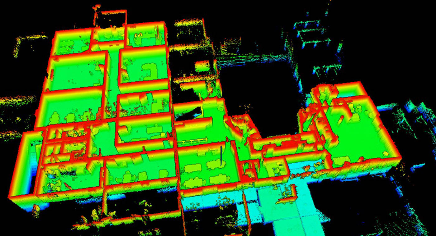
Many of the areas Shamrock+ captures are large exteriors and the 100m range of the ZEB Horizon makes it an ideal solution. The team carried out an architectural scan of an approximately 10,000 sq. ft Community Bible Church (CBC) in Savannah, GA. This project consisted of 3 individual scans of the interior building and its surrounding area, with the scan time ranging from 10 to 30 minutes.
Shamrock+ uses the ZEB Horizon laser scanner on UAVs, handheld and mounted to a car. The versatile solution provides Shamrock+ with the ability to switch from air-based data capture to scanning large areas in a very short amount of time.

Creating 3D BIM files, floorplans and more with GeoSLAM technology
Shamrock+ has completed more than a dozen projects to date, each with its challenges. From scanning building interiors for renovation to mapping acres of land for topographical data, the ZEB Horizon has proven to be a tool that can overcome the challenges it has faced so far.
Shamrock+ processes the ZEB Horizon's data using FARO Connect. They also internally integrate the point clouds into other software platforms to create 3D BIM files, floorplans, elevations, contours and much more.
By using mobile LiDAR technology, Shamrock+ can capture large acres of land in a short period. This speeds up their data collection process without sacrificing accuracy, which allows them to spend more time creating high-quality visual solutions for their clients.