Datenblatt

Erleben Sie Genauigkeit und Vielseitigkeit mit dem Orbis Premium Mobile Scanner

Orbis Techsheet

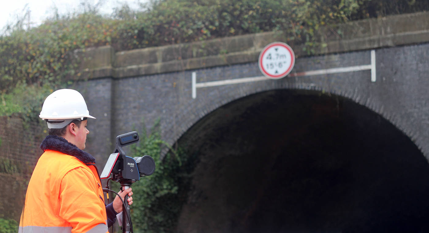
Mit einer neuen, leistungsstarken Kamera, robustem IP54-Schutz und leistungsstarker Flash Technology für schnelle Scans mit hoher Dichte hebt der FARO Orbis Premium Mobile Laser mobiles Scannen auf die nächste Stufe. Selbst in den anspruchsvollsten Umgebungen präzise Erfassung lebendiger, farbiger Punktwolken.

Entdecken Sie alle Vorteile des Orbis Premium.

Bewusstseinsbildung
Inbetrachtziehung
Bau und Konstruktion
Sammlung
Design und Planung
Wartung und Bedienung
Strafverfolgung und Verwaltung
Rekonstruktion und Analyse
Vermessung
Ermittlung bei Verdacht auf Brandstiftung
As-Built Bestandserfassung und -modellierung
Qualitätskontrolle Baugewerbe
Präsentation vor Gericht
Unfallrekonstruktion
Tatortuntersuchung
Digitale Zwillinge für Anlagen- und Gebäudemanagement
Störungsermittlung
Denkmalschutz
Sicherheitsplanung
Architektur, Ingenieur- und Bauwesen
Energie und Rohstoffe
Brand und Rettung
Forensisches Engineering
Forstwesen
Geodaten
Versicherung
Strafverfolgung
Anbieter von Messdienstleistungen
Medien- und Unterhaltungsbranche
Bergbau
Orbis
FARO Sphere
Software – Architektur, Ingenieur- und Bauwesen
Software – Messtechnik und Qualitätskontrolle
Software – Öffentliche Sicherheit und Forensik
Datenblatt
Architektur, Ingenieur- und Bauwesen
Analytik für die öffentliche Sicherheit

Abonnieren Sie unseren Newsletter, um auf dem Laufenden zu bleiben.

Verwandte Inhalte

Filter

Filter

ARTICLE

GD&T for beginners: MMC & bonus tolerance, explained in 3D

Visualization challenges in 2D and 3D documentation for geometric dimensioning and tolerancing and the scanning and probing tools needed to measure hard to reach locations.
INFOGRAPHIC

How Reality Capture Tech Empowers General Contractors

Learn how FARO hardware, software, and cloud-based solutions empower General Contractors with impressive organizational and project line-of-sight capabilities by downloading this engaging infographic.
ARTICLE

What Is Lidar and How Does It Work?

LiDAR is an acronym for Light Detection and Ranging and is a remote sensing method for capturing and creating 3D models of the real world.
Article

Understanding Laser Scanners

When complex or large environments need to be documented, Laser Scanners provide a practical and economical solution. Traditionally, capturing la…
Tech Sheet

FARO® SCENE Software

Learn about the most intuitive and efficient software featuring interactive and hybrid scan registration
WEBINAR

Exploring 3D Metrology and Additive Manufacturing

Learn how Kindig-It Design harnesses the power of 3D metrology and additive manufacturing in their custom car fabrication process.
Tech Sheet

Tracer M Laser Projector

The Tracer M Laser Projector accurately projects a laser line onto a surface or object, providing a virtual template to quickly and accurately po…
CASE STUDY

The Benefits of 3D Tech for Electric Vehicle Battery Assembly

Key to future electric vehicle sales is reduced costs and waste, especially as that waste relates to battery assembly. See how 3D laser scanning and FARO technology can help.