Geospatial Solutions: Unlock Insights With 3D Laser Scanning
Geospatial solutions like 3D laser scanners are streamlining surveying workflows by digitizing the physical environment with high accuracy. Advanced technologies are transforming industries like survey mapping, civil engineering, mining, and forestry by providing detailed data for spatial analysis and decision-making. 3D scanning tools and software packages from FARO Technologies are driving innovation across various geospatial applications, including plotting complex terrains and underground mapping.
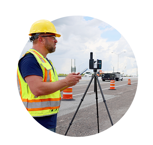
Capture high-quality data with Geospatial Solutions from FARO Technologies
Surveying and Mapping
Transform surveying and mapping with precise, high-resolution 3D data to create fast and accurate maps of complex landscapes.
Mine Surveying
Boost productivity and enhance safety with cutting-edge reality capture solutions tailored for quick and efficient data collection.
Forestry
Generate detailed maps of large forest areas to understand tree density, carbon volume, and terrain for improved forest management, resource planning, and conservation efforts.
Geospatial industry insights
By choosing FARO, you’ll benefit from our 40+ years of experience with reality capture technology which has led to cutting-edge geospatial solutions that continue to innovate year after year. We’ve collected all our geospatial insights in a library of resources for you
Geospatial Solutions Spotlight
FARO Focus Laser Scanners
The FARO Focus series offers accurate 3D scanning for surveying and infrastructure planning workflows.
FARO Orbis Premium
The FARO Orbis Premium SLAM scanner is fast, accurate, and versatile—ideal for large or complex spaces.
FARO Sphere XG
FARO Sphere XG is a central hub for analyzing 3D data captured with FARO geospatial solutions.
FARO As-BuiltTM Software
FARO AsBuilt guarantees a direct workflow from captured reality data into usable CAD models and/or BIM
We can now provide a good point cloud or model with reasonable accuracy in a short amount of time at a price that eliminates non-scanning competition offerings, and is less than clients who use scanners from other manufacturers.
Tommy Maddox
BC Engineering & Design LLC
Reduction in travel expenses due to speed of capture. Increase in quality of deliverable over hand measurements. Decrease in rework costs due to lack of information/bad information of hand measurements.
Jaymin Read
Architectural Graphics Inc.
The greatest benefits of the laser scanning solutions [are] only having to visit the site once and being able to gather hard-to-access measurements.
Rodney Roebuck
Roebuck Contracting Inc.