導入事例

空間プランニング専門業者、FARO FOCUS3Dを使い、現場測量を実施 – プロフェッショナルレーザース…

Perform_field_surveys_using_FARO_FOCUS3D_a_specialist_in_spatial_planningProfessional_Laser_thumb

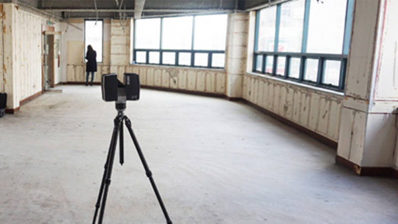
空間プランニング専門業者、FARO FOCUS3Dを使い、現場測量を実施 – プロフェッショナルレーザースキャニングソリューションにより、TOZの測定課題を解決 建築: TOZ Group
スキャナー導入後、TOZは測量時間を2時間から1時間へと50%も短縮し、計測誤差の80%削減を実現しました。以前、マニュアルで行っていた計測値の誤差範囲は約100mmから150mmでした。Focus3Dを使うと、誤差範囲は20mmから30mmにまで減り、これはTOZの公差を十分満たす数値でした。スキャナーのもう一つの利点は、Focus3Dがスキャンしている間、手動式計測機器を使い、同時に補助的な計測が可能となったことでした。これにより、時間短縮を実現しながら、総合的な生産性を最大限に向上できました。


導入事例
建築、エンジニアリング、建設
As-Builtキャプチャとモデリング
建築、エンジニアリング、建設
3Dスキャナー
Focus
測量と測定
検討

ニュースレターを購読して最新情報を入手してください。

関連コンテンツ

WEBINAR - UK

From Site to Insights, in a Blink™

Watch how the Blink™ Imaging Laser Scanner makes reality capture as easy as pressing a button.
Thursday, July 10, 2025
01:00 PM - 02:00 PM
ARTICLE

Surveying Equipment: Tools and Technologies for Accurate Measurement

From traditional land boundary surveys to advanced geospatial mapping, today’s surveying equipment reflects decades of evolution, all aimed at improving accuracy, efficiency, and data integrity.
ARTICLE

Reality Capture Technology: Choosing the Best Solution for You

Explore FARO's reality capture solutions to determine which option aligns with your business goals for the best return on investment.
WEBINAR RECORDING

From Site to Insights, in a Blink

Watch how the Blink Imaging Laser Scanner makes reality capture as easy as pressing a button.