Focus Terrestrial Laser Scanner

Designed for capturing precise 3D digital models that turn uncertainty into confidence with reality data you can trust.

Whether documenting existing conditions, verifying progress, capturing a crime scene, or planning the next phase of work, every decision depends on the quality of the data behind it. Focus terrestrial laser scanners help project teams and investigators make those decisions with confidence by capturing reality data that provides a clear and reliable understanding of the world. From everyday documentation to survey-grade reality capture, the Focus delivers the accuracy, efficiency, and reliability required to transform real-world environments into trusted digital reality data.

Contact Us

Get Ready for the INSIGHT Generation of Reality Capture

Discover the latest additions to the Focus laser scanner portfolio. Focus i.1 and Focus i.1 X help teams capture and share reality data more efficiently, from the field to finish. Download the technical specification for more details or contact us to learn more about how these new scanners can positively impact your existing workflows.
Focus
  • Versions
  • Value
  • Performance
  • Features
  • Applications

Scanner Versions


FARO Focus Core

The FARO Focus Core is designed to suit various operations and public safety analytic workflows, offering a 100-meter range and up to 2mm accuracy. The scanner is available with an optional 1-year license to FARO Flash and a perpetual license to FARO Stream. Additionally, it comes with a standard 2-year manufacturer's warranty.

FARO Focus Premium

Focus Premium is the versatile choice for AECO professionals who need dependable reality capture throughout the project lifecycle. Whether documenting existing conditions, verifying designs, tracking construction progress, or creating as-built deliverables, it helps teams work with efficiency while balancing speed and ease of use. With coverage of up to 200 meters, it enables accurate documentation of larger areas while supporting informed project decisions.

FARO Focus Premium Max

Built for large-scale geospatial and infrastructure applications, the Focus Premium Max helps teams cover more ground with fewer scan positions, reducing time in the field while delivering comprehensive datasets for analysis, planning, and decision-making. Its 400-meter range makes it ideal for documenting expansive sites and complex outdoor environments, such as corridor mapping or infrastructure surveying.

Focus i.1

Focus i.1 is built for professionals who need exceptional accuracy and confidence in every scan. With up to 0.9 mm object scanning accuracy, it offers the precision required for demanding survey-grade, AECO, and public safety workflows while helping ensure reliable results from the start. It captures high-resolution color data in approximately 20 seconds with included Flash technology, enabling teams to efficiently create rich, detailed digital representations of real-world environments. An included localizer attachment enhances the capture experience by tracking scan positions, while the Insta360 X6 PanoCam adds valuable visual context.

Focus i.1 X

Focus i.1 X extends the precision and capture capabilities of Focus i.1 to large-scale outdoor and geospatial projects. Combining survey-grade precision with real-time georeferencing capabilities through an included GNSS/RTK receiver, it helps geospatial and AECO professionals efficiently document expansive sites while maintaining confidence in data accuracy. The upgrade streamlines field workflows by enabling data to be aligned and mapped to real word coordinates.

Business Value of the FARO Focus


Increase Productivity

Scan range options of 100m, 200m, and 400m and real-time feedback of pre-registered data through the FARO Stream App lead to faster and more comprehensive data capture.

Reduce the need for multiple setups, minimize errors or missed data, and enable faster on-site decision-making for increased productivity. The extended range of the Focus Premium Max is ideal for geospatial applications such as topographical surveys, boundary surveys, and large infrastructure projects.

Reduce Rework and Material Waste

Available in all Focus variations, Flash Technology increases data capture by over 50%, allowing for frequent on-site updates and ensuring projects are on track with original plans.

Greater visibility leads to earlier error identification and reduced rework and material waste.

From Small to Large-Scale Projects

The FARO Focus is an excellent surveying solution for capturing various areas, including large outdoor projects with its extended range and smaller areas with its speed of capture.

It is ideal for large construction sites, smaller public safety incidents, and everything in between.

Share Data Faster with Sphere XG

Upgrade to the Sphere XG Digital Reality Platform for seamless data sharing and collaboration. Effortlessly upload data from the FARO Stream App to Sphere XG, ensuring that all essential parties stay informed, regardless of location. This facilitates faster decision-making and enhances project visibility.

Versatile Data Processing

In addition to online data sharing via the cloud, FARO offers offline data processing in FARO SCENE.

For added peace of mind, the onboard SSD disk drive in the Focus scanners has 128GB of memory, which stores scans on the device and adds an extra layer of security around the data.

Interactive Registration for Large Complicated Projects

Efficiently process over 1000 scans and mix different registration types through the interactive registration tool in FARO SCENE.

This registration tool is ideal for larger, complicated projects and is designed to offer greater flexibility, speed, and easy georeferencing without expert information required.

FARO Focus Performance


Hybrid Reality Capture

FARO continues to bridge the gap between speed and accuracy with Hybrid Reality Capture, powered by Flash Technology*.

Flash Technology improves on-site productivity and ensures predictable accuracy on every project or forensic investigation.

Multiple Point Clouds, Multiple Devices

Sphere XG is designed as an easy-to-use data ecosystem containing data from various FARO hardware products. It allows users to bring in multiple point clouds from different sources to improve the visibility of a scanned area. This can facilitate better decision-making, project management, and collaboration with clients and stakeholders. Users can also review and compare multiple point clouds of the same location over time to understand changes in the data, track progress, and identify serious issues.

Software Compatibility

FARO offers a variety of export options for point cloud data to make importing into familiar third-party software, like Autodesk® ReCap, a smoother process.

Super-High Color Resolution

The latest color technology enables the Focus to capture scans with up to 266-megapixel color information for clearer point cloud data.*

*Panocam is required to operate Flash

FARO Focus Features


Halve the time spent scanning using Hybrid Reality Capture , powered by Flash Technology – Over 50% faster than traditional methods.
Improved scanning range—up to 400 meters—leads to superior area coverage per scan position. It is ideal for geospatial applications like topographical surveying, boundary surveying, or infrastructure projects.
No more "scanning blind".

Pre-registered data and greater visualization through the FARO Stream App help to identify gaps in the data or scan errors on-site in real time.
Upload data to Sphere XG and share it with key stakeholders for quicker decision-making or process data offline directly in FARO SCENE Software.
Control the scanner through the Stream App or directly on the screen through the intuitive interface.
Create projects, change scanner settings, manage image resolution, opt for color or black-and-white scans, group scans through clustering, and add annotations.
The rugged design, housing, and IP 54 rating help withstand the harshest environments daily.
Integrated high-speed SSD data storage of 512GB for maximum scan capacity and significantly faster processing.

Architecture, Engineering, Construction, and Operations

(AECO) Applications


Fast, Accurate Data Capture for Planning

Capture scan data to create accurate, complete datasets for various applications such as as-built documentation, Building Information Modeling (BIM), industrial facility management and infrastructure projects. These datasets form a strong foundation for conversions, extensions, space optimization, structural analysis, and maintenance.

Improved Construction Quality Control

Consistent and regular laser scanning during the construction process ensures that the final structure aligns with the design intent, reducing the risk of distortions and other issues. Calculating large volumes and inspecting free-form shape elements and facade components is also straightforward. Scan data is extremely valuable for project supervision and collaboration across different trades.

Geospatial Applications


Surveying and Mapping

Surveying professionals benefit from long-range and high-speed scans with Flash Technology, which reduces the time spent capturing data without sacrificing accuracy. Specifically, the FARO Focus Premium Max is the perfect solution for surveyors performing topographical surveys or working on large infrastructure projects.

Mine Surveying

Underground scanning with Focus is fast and accurate. Complete datasets for analyzing tunnel convergence to ensure mine safety and mapping production progress to increase productivity and save costs. Also, map stockpiles frequently for accurate volumetric data, enabling regular updates on mined materials.

Forestry Applications

Gain better insights from forests by utilizing accurate 3D point cloud data, which includes tree volume, carbon volume, above-ground biomass (AGB), species determination, and forest research.

Public Safety Analytics Applications


Crash Reconstruction

The FARO Focus scanner's speed and accuracy simplify evidence collection at crash scenes, resulting in faster turnaround times, improved public safety, and conclusive crash reconstruction data.

Crime Scene Investigation

Using FARO Focus, provide comprehensive, data-driven documentation of a crime scene, ensuring detailed preservation for future forensic analysis, such as blood spatter or bullet trajectory.

Pre-incident Planning

Frequently map infrastructure such as stadiums, public events, or schools using FARO Focus to provide up-to-date and accurate floorplan data for emergencies such as fire evacuations or school shootings.

3D Metrology Applications


Improved Quality Control and Inspection

The Focus Laser Scanner allows fast and easy data capturing in manual and fully automated modes for dimensional quality control or simple absence/presence inspection of large parts or assemblies. The terrestrial laser scanner is ideal for data acquisition of aircraft, heavy machines, or military equipment.

Enhanced Product Design and Engineering

FARO Focus improves the precision and efficiency of design and engineering procedures. If a product lacks CAD data, scanning it provides all the required measurements for reverse engineering. Scanning the intricate interiors is a foundation for planning modifications when creating fixtures and fittings for ships, cars, or aircraft.

Efficient Production, Fabrication, and Assembly

Rely on Focus Laser Scanners to maintain efficient production. Scan intricate machine components for manufacturing records or utilize the resulting 3D CAD data and dimensional control for precise-fit off-site assembly as required.

Trade In Your Old Equipment

We’ll take your old 3D metrology, imaging or realization hardware or software — any brand, any condition — and apply its value toward your purchase of the latest FARO solution. The FARO Xchange program makes your upgrade easy.
FARO INSIGHT Introduces New Reality Capture Solutions
NEWS

FARO INSIGHT Introduces New Reality Capture Solutions and Workflow Updates

FARO INSIGHT, a business unit of AMETEK, Inc., introduces Focus i.1 and Focus i.1 X terrestrial laser scanners and the Rovi i.1 reality capture package to its solution lineup.
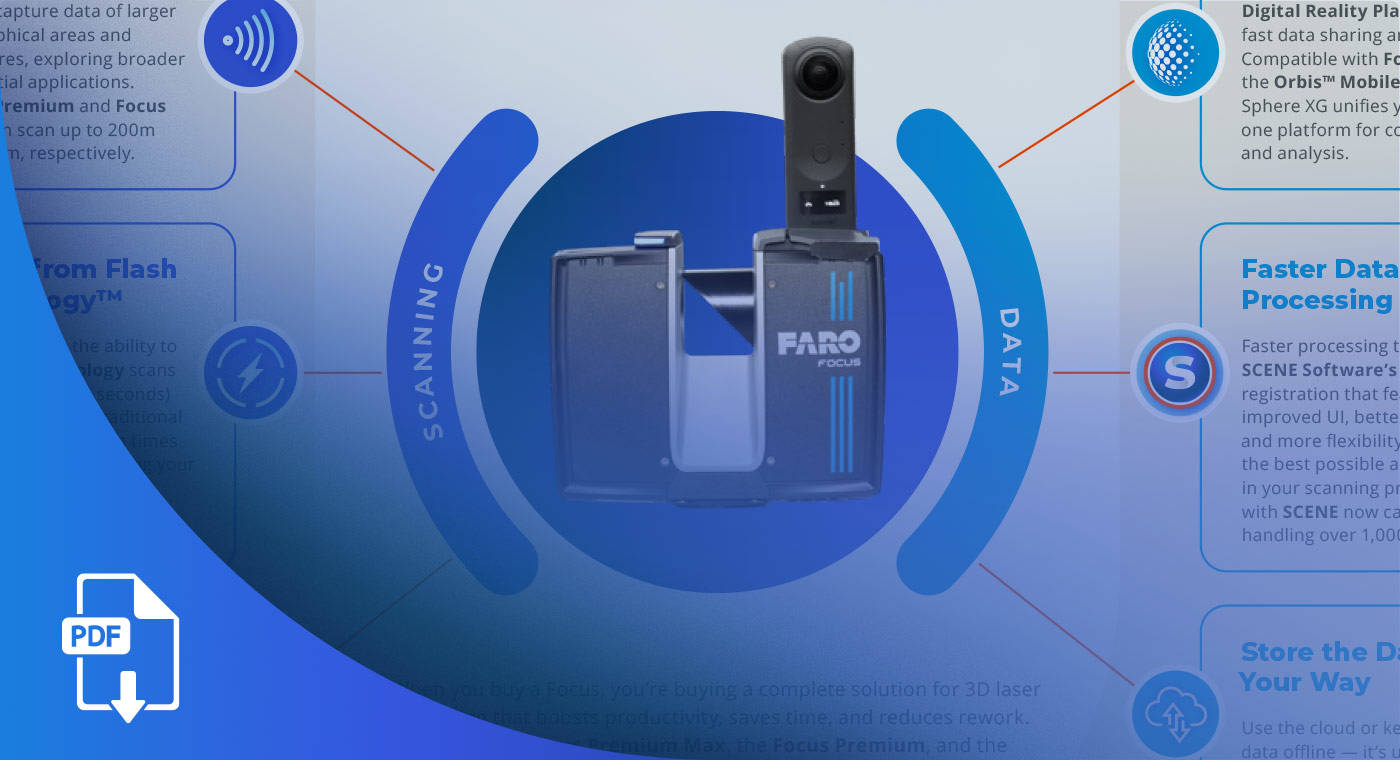
FARO Focus Laser Scanning Solution
INFOGRAPHIC

The FARO Focus Laser Scanning Solution

Discover the FARO® Focus Laser Scanner, featuring an expanded range of up to 400 meters, Hybrid Reality Capture powered by Flash Technology scans, and a comprehensive software suite for enhanced productivity in 3D scanning.
FARO INSIGHT Introduces New Reality Capture Solutions
NEWS

FARO INSIGHT Introduces New Reality Capture Solutions and Workflow Updates

FARO INSIGHT, a business unit of AMETEK, Inc., introduces Focus i.1 and Focus i.1 X terrestrial laser scanners and the Rovi i.1 reality capture package to its solution lineup.
FARO Focus Laser Scanning Solution
INFOGRAPHIC

The FARO Focus Laser Scanning Solution

Discover the FARO® Focus Laser Scanner, featuring an expanded range of up to 400 meters, Hybrid Reality Capture powered by Flash Technology scans, and a comprehensive software suite for enhanced productivity in 3D scanning.

Product Details and Resources

TECHNICAL DOCUMENTATION

Focus Laser Scanner Knowledge Base

Find all the technical documentation you need, from user manuals to specs.
Video

The Newest FARO Focus Laser Scanner is Here

The Focus Premium Laser Scanner is a next-generation reality capture device that delivers faster scans and better results.
Video

Scenes Scanned Faster with the New Focus Premium Laser Scanner and Stream Mobile App

See how the new FARO® Focus Premium Laser Scanner and FARO® Stream mobile app help keep the public and law enforcement safe.
WEBINAR

How Denmark’s Largest Technological Installation Business Utilizes Reality Capture

Kemp & Lauritzen has adopted Focus Laser Scanners for documenting large areas with high detail and accuracy.
WEBINAR

Jobsite Execution Using Remote Coordination Capabilities

Remote collaboration is a paradigm shift for many construction projects. Focus Laser Scanners make it easy.

Related Products

FARO® Orbis Mobile Laser Scanner

FARO Orbis is the all-in-one mobile laser scanner with integrated static scanning capabilities, powered by FARO FLASH technology.

FARO Sphere® XG

Achieve faster reality data capture and project success through a centralized cloud ecosystem built specifically for FARO service platforms and related applications.

SCENE Software

For processing and managing scan data with real-time on-site registration, automatic object recognition, scan registration and positioning.

FARO Zone 3D Software

Produces stunning visuals with 2D/3D diagrams, analysis, animations and videos.
This is currently the best technology on the market for our purposes.
Helmut Hörmannseder
Linsinger ZT GmbH
The combination of the new Focus® Laser Scanner, Stream, and Sphere … is going to cut our scanning and processing time down by 60% easily. This time savings will allow us to examine scanning projects more frequently, scanning projects we normally wouldn’t have because of time constraints, and expanding our offerings to customers.
Travis Voss
Helm Group
The new FARO® Focus Laser Scanner has some excellent speed improvements that will minimize times at crime and crash scenes.
Eugene Liscio
Ai2-3D Forensics

Recently Viewed Products

Schedule a demo below to see how a FARO Focus Laser Scanning Solution would benefit your business.

Schedule a Live Demo