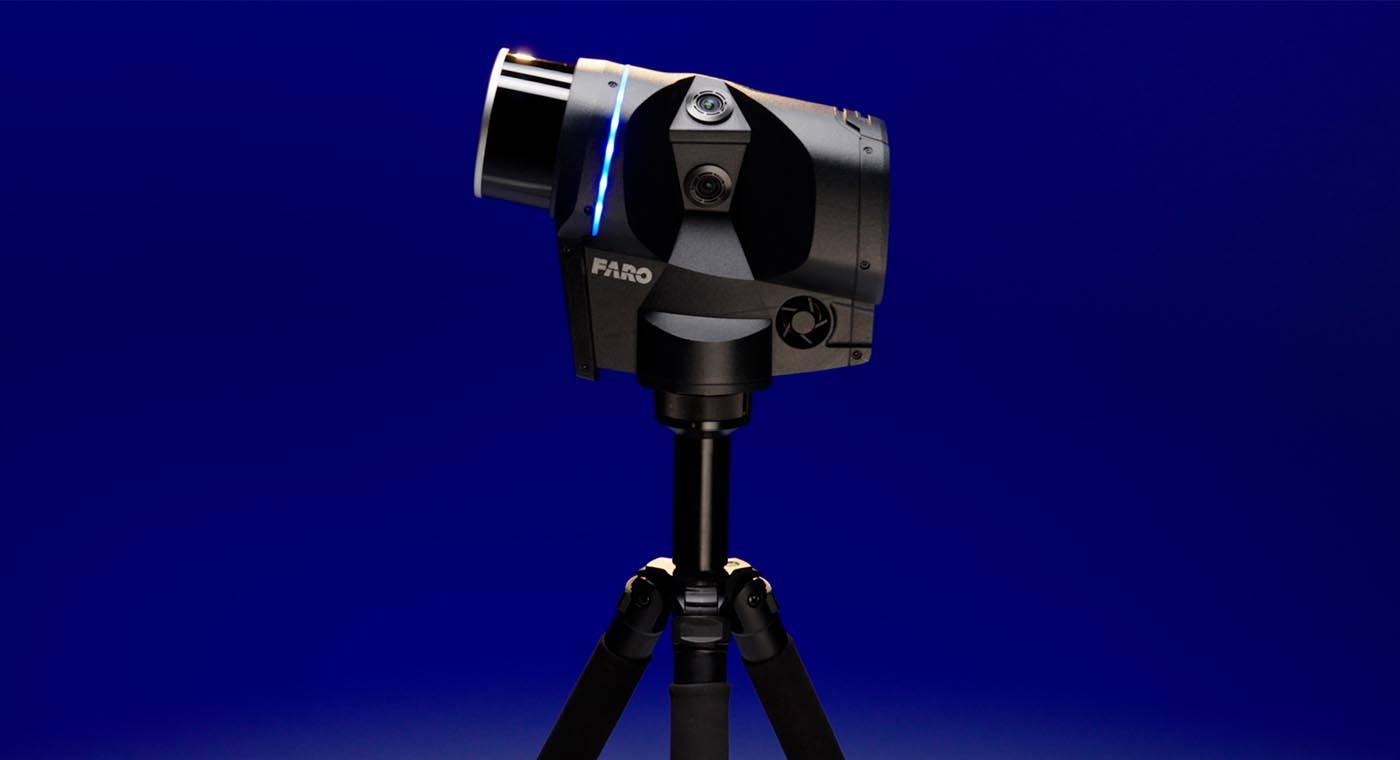
Blink Imaging Laser Scanner

Reality capture for everyone through intuitive online and offline workflows, stunning visuals and clear insights.

Blink is a reality capture solution designed for speed, simplicity, and accessibility. It offers high-quality 360° images, backed by precise point cloud data for measurements, into the hands of designers, builders, surveyors, operators, and public safety professionals, for capturing, viewing, and sharing data regardless of expertise. Blink, combined with both online and offline workflows, lets anyone can take control of reality capture and move projects or cases to final delivery efficiently.

Discover how Blink can simplify your workflows, save you time, and boost your project/evidence gathering efficiency.

Download the Brochure for AEC
  • Value
  • Features
  • Insight

Turning Data to Decisions

Capture a scene with real-time feedback on the Stream app, and upload data automatically to the cloud-based platform, FARO Sphere XG, for processing, sharing, and decision-making. Alternatively, keep data local by uploading it into SCENE, where it can be processed, cleaned, and used to gain clear insights.

Collaboration on a Digital Jobsite

Collaborate remotely via the FARO Sphere® XG cloud on a digital jobsite. Blink provides professional results: stunning visual quality backed by precise point cloud data. It gives stakeholders dependable data for effective decision-making.

Scanning Made Simple

Blink makes scanning as easy as taking a photo. Capture, review, and share — all within minutes. Fast, efficient progress tracking on your jobsite that starts with the push of a button.

Guided Scanning with Real-Time Feedback

The scanner itself provides real-time feedback and guidance. If you've never scanned before, Blink’s light indicator will tell you if you've moved too far out of position, thus ensuring that optimal scan positions are found — making registration easier and improving scan quality. This intuitive, guided scanning process was designed to make laser scanning accessible to everyone.

Imaging Laser Scanner Accuracy

Blink provides stunning visual quality backed by precise point cloud data for measurements. It offers up to 4 mm accuracy and 50-megapixel imagery, so stakeholders can make clear decisions from a digital jobsite, improving workflow efficiency through better insights.

FARO Sphere XG

Blink’s interaction with the Sphere XG cloud solution offers a centralized, collaborative environment where you can upload, automatically process data, and organize 3D scans, 360° images, and 3D models, enabling actionable insights from anywhere in the world. Insights from within the platform include orthophoto generation, the creation of floorplans, and automated leveling of scans, including much more functionality.

SCENE Software

If online workflows are not feasible, FARO INSIGHT offers offline processing in SCENE, where data can be processed, registered, cleaned, and shared. Gain insights from the resulting data within the platform, export into various point cloud formats (.las, .laz, .e57, etc.) to upload into familiar third-party software or upload it directly to Sphere XG for greater collaboration with your stakeholders.

No More “Scanning Blind”

No More “Scanning Blind” Check your progress while you’re on the jobsite from within the Stream app. No more waiting to get back to the office to preview the data you’ve captured. With easy pre-registration and real-time project tracking, the Stream App leads you through the data capture process and lets you check your data as you go.

Project Managers: Progress Tracking

Blink provides a single source of truth with high-quality visuals, empowering field teams to confidently capture every detail more often on more jobsites, without needing to bring in a reality capture expert. Compare planned vs actual conditions to verify progress, validate work, and keep projects on track.

Superintendents: On-Sure Issue Resolution

Resolve on site issues faster with indisputable, transparent and easy to understand information about the task at hand. Use real-world data to check installations and confirm clearances, resolving issues before they escalate.

Facility Managers: Comprehensive Oversight

Maintain oversight with accurate, detailed 3D visual documentation annotated with supplementary materials. Access and understand assets in context to plan maintenance, manage systems, and support operations.

3D Scanning Service Providers: Quick and Simple Data Capture

Speed up your data capture offering and provide high-quality deliverables with Blink. Capture, process, and share data with your customers via the Sphere XG cloud.

Public Safety: Scene Documentation and Pre-Incident Safety Planning

Quickly capture high-quality 3D visuals for crime, crash, and fire scenes while supporting pre-incident planning, security assessments, and evacuation mapping.
The Blink Imaging Laser Scanner Technical Product Demo
VIDEO

The Blink Imaging Laser Scanner: Technical Product

See the Blink Imaging Laser Scanner in action! This imaging laser scanner captures 3D point clouds and 360° photos with ease. Watch how it simplifies scanning, processing, and sharing.
Blink was incredibly user-friendly, with a simple and intuitive scan-and-upload process. The automated registration and alignment of scans is a huge advantage, saving time and effort. Best of all, the scans were available for viewing on the web in Sphere XG within hours of leaving the site.
Abe Morris, Design Technology Manager, SSR
I recently had the chance to trial the FARO Blink, and I was impressed by its quick scanning speed and the clean, error-free processed data in Sphere XG. Using it with the FARO Stream App was straightforward, and the integrated cameras delivered accurate colors.
David Cacioppo, Officer, Park Ridge Police Department

Ready to learn more about how Blink can help your operations?

Contact Us Now

Recently Viewed Products