Insight You Can Build On

Bring clarity to today’s decisions and confidence in tomorrow’s outcomes.
Focus I Laser Scanner

Understand Reality & Shape What Comes Next

The quality of what comes next depends on how well you understand what exists today.

Every project, place, and community is shaped by decisions. Before a design is approved, infrastructure is planned, or an incident is investigated, people need a clear understanding of the reality in front of them. Because when people can see the world clearly, they make better decisions about how to improve it, protect it, and plan for what comes next.

For generations, organizations have turned to FARO INSIGHT to create that understanding. Through reality capture and digital measurement, we help professionals across the built environment, geospatial, and public safety sectors build a trusted view of the world around them.

Capture

Capture

Process

Process

Insight

Insight

Decision

Decision

Tackling the Challenges You Face

  • Architecture, Engineering, Construction, and Operations (AECO)

  • Geospatial

  • Public Safety Analytics

Design Validation

Compare real-world conditions against design intent before construction begins. Resolve clashes and constraints early to reduce redesign costs and project delays.

Infrastructure Planning

Build a comprehensive digital view of existing infrastructure and site conditions to enable better planning decisions, reduce project risk, and improve resource allocation.

Pre-installation Quality Assurance

Verify field conditions before installation and prevent costly rework by ensuring components fit correctly the first time.

Deviation Management

Monitor differences between planned and actual conditions throughout a project. Identify issues early and take corrective action before they impact schedule or budget.

As-Built Documentation

Capture the completed asset in accurate 3D detail to create a trusted digital record. Support future renovations, maintenance, and lifecycle decision-making with confidence.

Operations Optimization

Transform asset data into actionable operational intelligence to improve maintenance planning, increase asset performance, and minimize downtime.

Surveying and Mapping

Capture reality at scale to create accurate maps and geospatial models that provide a trusted foundation for planning, design, and decision-making.

Forestry

Map forest environments to better understand and manage natural resources. Monitor resources, assess environmental conditions, and support sustainable management.

Mining

Monitor changing mine conditions with accurate geospatial data for improving planning, productivity, and operational safety.

Heritage Preservation

Digitize history and preserve its heritage in support of conservation and restoration efforts.

Crime Scene Analysis

Capture scenes in complete 3D detail; preserving key evidence for investigators to digitally analyze, strengthen case development, and create courtroom ready presentations.

Crash Reconstruction

Accurately document crash scenes faster and turn physical evidence into digital insights that support reconstruction, reporting, and courtroom communication.

Disaster Management

Create digital representations of environments before, during, and after incidents. Enable faster response, informed decisions, and improved recovery across the disaster management cycle.

Why FARO INSIGHT?

Reduce Risk and Rework

Incomplete or unclear data leads to misalignment and costly rework. FARO INSIGHT solutions document conditions accurately and consistently, reducing uncertainty and improving coordination. With accurate records in place, you can catch issues earlier, avoid delays, and stay in control of project outcomes and timelines.

Confident Decisions from Reliable Insight

When project decisions depend on real-world conditions, teams need information they can rely on. FARO INSIGHT provides reliable, trustworthy insight across projects and environments. By creating one consistent view of reality, stakeholders align faster and move forward with confidence at every stage of planning, execution, and review.

Improve Collaboration and Accountability

When teams work from shared information, clarity and consistency matter most. FARO INSIGHT offers a single, trusted source of truth that strengthens communication across stakeholders, supporting coordination, documentation, and accountable decisions across complex workflows and distributed teams.

Act Fast with Ready-to-Use Information

Captured data is most valuable when teams can review and act on it quickly. FARO INSIGHT transforms captured environments into insight that is ready to analyze and apply earlier in the workflow. Teams gain clear context sooner, reducing delays, and keeping work moving across operations.

Products Spotlight

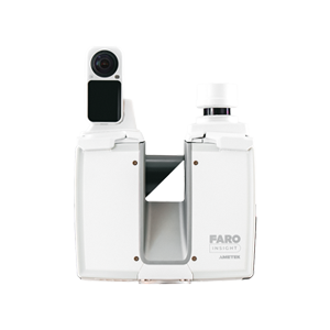
Focus
High-precision terrestrial laser scanning for capturing detailed and survey-grade data.
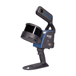
Orbis Premium
Mobile scanning for quickly capturing large spaces and sites while moving through them.
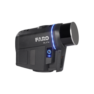
Blink
Easy to use imaging laser scanner that captures 360o images and 3D data for simplifying workflows.
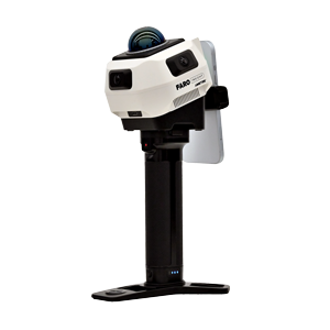
Rovi i.1
An affordable all-in-one reality capture package that includes data capture, processing, and insights.
Sphere XG
FARO Sphere XG
Cloud-based reality capture platform for processing, viewing, sharing, and collaborating on data anywhere.
SCENE
SCENE
Desktop software for processing, registering, and managing high-quality 3D scan data.
As-Built
As-Built
Create CAD drawings and BIM models from laser scan data in the As-Built Software Suite.
Build IT
BuildIT Construction
Compare existing site conditions against CAD drawings, BIM models, and project standards.
Zone 3D
Zone
Analyze crash & crime scenes, reconstruct events, review evidence, and create courtroom-ready presentations.

Product Details and Resources

NEWS

FARO INSIGHT Introduces New Reality Capture Solutions and Workflow Updates

FARO INSIGHT, a business unit of AMETEK, Inc., introduces Focus i.1 and Focus i.1 X terrestrial laser scanners and the Rovi i.1 reality capture package to its solution lineup.
CASE STUDY - FARO INSIGHT

How Matrix Technologies Delivered Sitewide Insight for a Leading Chemical Manufacturer

Explore how Matrix Technologies used 3D scanning to map a complex chemical facility, gathering clear data for insights on future planning.
Webinar

Capturing the Complete Picture of Modern Public Safety Investigations

Listen to industry experts from FARO INSIGHT and Skydio as they explore how public safety agencies are using drones, photogrammetry, and laser scanning for a complete picture of their scenes.
Webinar

Turning Reality Capture into Actionable Insight for Better Facility Workflows

This on-demand webinar explores how Energy Northwest transformed reality capture data into a connected digital reality workflow that supports maintenance, planning, and facility operations.
INFOGRAPHIC

Choosing the Right 3D Laser Scanner for Surveying and Mapping

Explore how advanced 3D reality capture technology like FARO Orbis™ & FARO® Focus Laser Scanners support a range of mapping tasks, from infrastructure surveys to volumetric analysis.
The combination of Blink and FARO Sphere XG has been a real advantage to us. The hardware and software work seamlessly together, making them easy to adopt. And with rapid development and high-quality, FARO INSIGHT continues to deliver real value to our company
Stefan Van Meurs
Chief Operating Officer, Wulverhorst B.V.
Facilities that lack legacy documentation often face challenges when planning upgrades or repairs. By creating a detailed digital model of the site, we’ve helped the client establish a reliable reference that supports everything from maintenance planning to major capital projects
Nathan Vallade
Project Engineer, Matrix Technologies, inc.
FARO INSIGHT allows us to document crash scenes quickly and accurately without extended roadway closures, helping us capture the data we need while minimizing disruption to traffic
Bryan O’neil
Reconstructionist, O’neil Forensic Reconstruction LLC

FAQ

  • What is FARO INSIGHT?

    FARO INSIGHT is a provider of 3D reality capture solutions that turn real-world conditions into trusted insights. It helps AECO, geospatial, and public safety teams gain a clear understanding of buildings, sites, and scenes to plan effectively, improve coordination, and act with confidence.

  • How is FARO INSIGHT different from FARO CREAFORM?

    FARO INSIGHT focuses on reality capture and the transformation of real-world data into usable insights. While FARO CREAFORM focuses on precision measurement for manufacturing, FARO INSIGHT is designed to accurately capture environments at scale and convert that data into a shared understanding that supports decision-making across workflows.
  • What products or platforms are part of FARO INSIGHT?

    FARO INSIGHT includes terrestrial, mobile, and imaging laser scanners, along with supporting software and cloud-based platforms. These solutions work together to capture, process, and visualize spatial and visual data, enabling teams to create accurate representations of real-world conditions.
  • Who uses FARO INSIGHT?

    FARO INSIGHT is used by professionals responsible for capturing, documenting, and understanding physical environments. This includes architects, engineers, surveyors, construction managers, BIM specialists, forensic investigators, public safety teams, and infrastructure planners working across complex projects.
  • Which industries benefit most from FARO INSIGHT?

    Industries where accurate, reliable data is critical to decision-making benefit most from FARO INSIGHT’s solutions. This includes Architecture, Engineering, Construction, and Operations (AECO), public safety, and geospatial sectors, where teams rely on clear documentation and shared understanding to analyze real-world conditions and plan projects accordingly.
  • How does FARO INSIGHT work with other FARO technologies?

    FARO INSIGHT integrates a broader ecosystem of measurement and software solutions to support connected workflows. By combining reality capture data with other tools for inspection, verification, and analysis, FARO INSIGHT creates a more comprehensive understanding of environments across different stages of work.
  • How do customers get started with FARO INSIGHT?

    Customers typically start by consulting with a FARO INSIGHT expert to review their workflows and identify where clear insight into real-world conditions can improve outcomes. They can see relevant solutions in action through a demo and select the option that best aligns with their needs.

The right reality capture solution starts with a conversation.

Talk to our experts