
Ensuring success on land development projects comes down to confidence in your survey data and planned outcomes, amid increasingly complex project demands. These could involve working on terrain exposed to existing earthworks, on steep slopes, with heavy vegetation, or under other environmental conditions.
While facing these challenges head-on, the confidence of surveyors and geospatial professionals remains driven by the ability to capture accurate site information quickly and efficiently. Clear spatial data from a topographic survey is the conventional way of understanding terrain, and over the years there have been multiple manual ways to capture this data.
In recent decades, the integration of reality capture solutions, like terrestrial laser scanners, into the workflows of surveying professionals has streamlined how site documentation, progress management, and stakeholder collaboration are handled. This article aims to understand how modern digital reality solutions enhance the standards of spatial data and streamline collaboration for stronger outcomes.
Why is Surveying for Land Development Important?
Having an accurate and measurable survey keeps projects on track and within budget through a better understanding of the land, by:
Reducing work
Surveyors pre-empt downstream problems that lead to rework by visually identifying concerns earlier, highlighting issues with proposed designs, and improving stakeholder communication.
Improving Timeline Control
Land development projects, with the correct information ahead of breaking ground, avoid unexpected issues that delay or derail projects with negative impacts on project delivery and budgets.
Supporting Compliance & Safety
Detailed topographic surveys enable surveyors to validate proposed designs against actual site conditions, ensuring alignment with safety and compliance regulations, that could lead to heavy fines if not complied with correctly.
Leaving a Paper Trail
A digital footprint of the land before work begins not only safeguards the decisions made by project stakeholders but also provides a record for future renovations or required adjustments.
How Does Digital Reality Technology Improve Topographic Surveys?
Understanding the terrain, its existing conditions, limitations, and surrounding elements, is the foundation of a successful construction project. Digital reality solutions, like 3D laser scanners or drones, capture mass amounts of data, which lead to detailed, accurate, and measurable representations of the environment. This translates to clear insights of existing structures, surrounding features, slopes, or gradients, and other environmental contexts to guide future decisions.
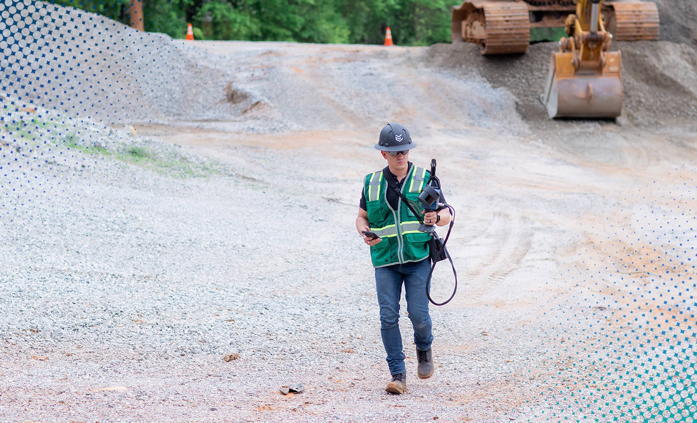
Laser scanners from FARO INSIGHT, like the Focus Series and Orbis Premium, enable surveying professionals to very accurately capture large, complex spaces. Including undeveloped terrain, vegetation-dense areas, hills and slopes, and existing infrastructure like electricity pylons. This objective view of the real world limits the risk of missing critical details and ensures that project decisions are made with accurate data and confidence.
Do 3D Laser Scanners Improve the Speed of Data Capture?
When it comes to tight budgets and tough timelines, speed matters—but not at the expense of quality or safety. Modern 3D laser scanners aim to bridge that gap and offer solutions that capture high accuracy data from site, faster, and convert that data into usable insights.
Terrestrial Laser Scanner
The Focus static scanner offers highly detailed, accurate surveys through 30 second scans from each scan position. Ideal for quickly capturing key areas like elevation or vegetation.
Mobile Laser Scanner
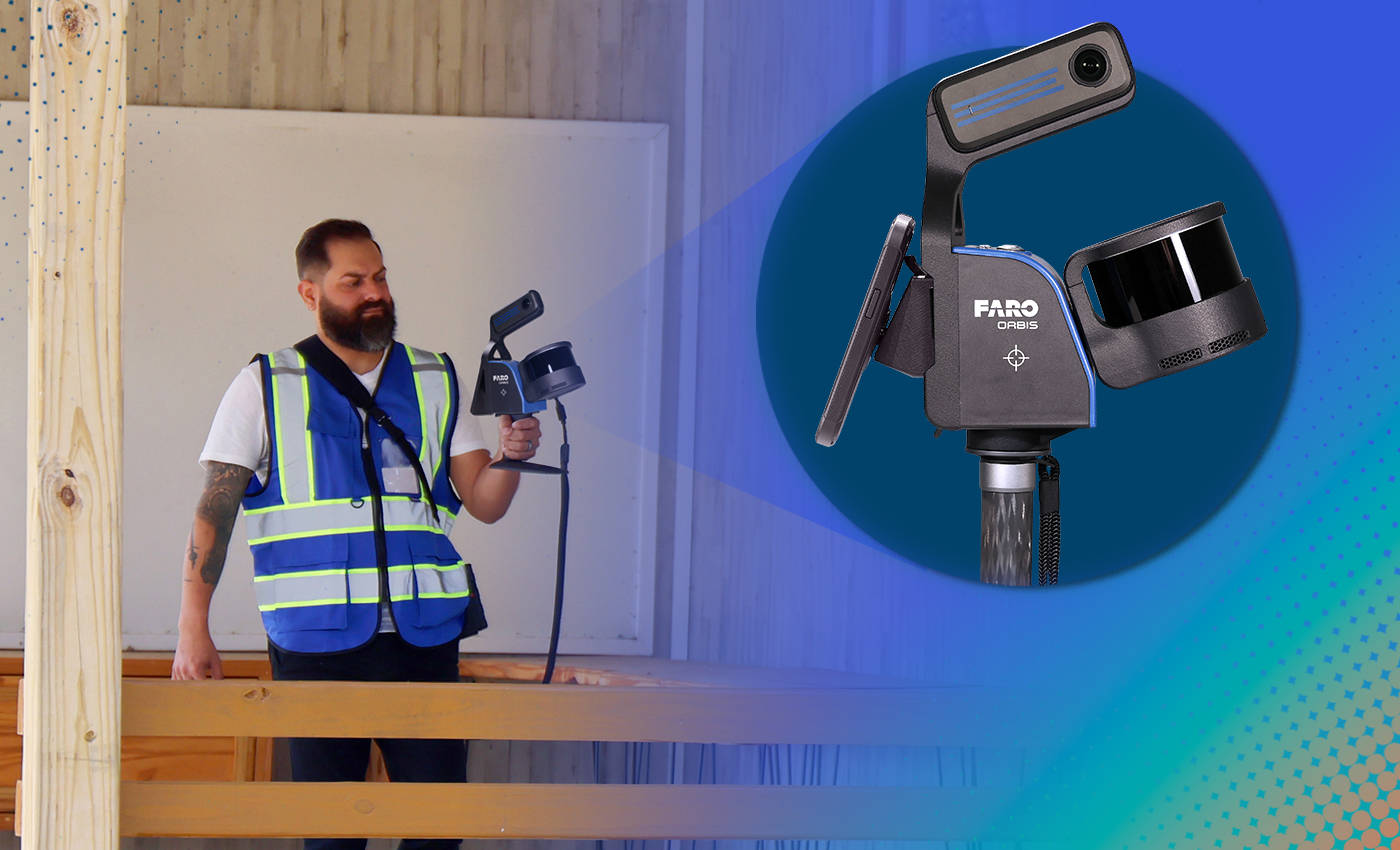
Meanwhile, Orbis Premium allows professionals to capture entire sites and perimeters within hours thanks to its mobile, handheld nature. The mobile solution helps with identifying potential issues, like clash detection with pylons.
Cloud-based Processing & Collaboration
The process is sped up even more through cloud-based processing from site, by sending captured data directly to FARO Sphere XG from the Stream app. This single hosting and sharing platform for processed datasets empowers teams to analyze multiple aspects of the site and share terrain findings with stakeholders, helping to accelerate project timelines and ensure uninterrupted progress.
Making Data-Backed Decisions
Data-driven land development decisions are easier when teams are aligned and working from the same information. A digitized representation of the real-world environment gives project stakeholders the required details to make decisions with confidence, without the need to visit the site. Here are some examples where digital reality helps:
|
Surveying Challenge |
How Digital Reality Helps |
|
Limited visibility of terrain |
Complete site capture with measurable context |
|
Rework due to inaccurate data |
Early identification of design conflicts |
|
Budget overruns |
Better planning from accurate surveys |
|
Poor stakeholder alignment |
Shared, visual site data |
Reality capture technology provides objective visual insights and data to support informed decisions, ensuring that design intention, field conditions, terrain elements, and stakeholder feedback are aligned to deliver intended outcomes. Data can be fed into traditional workflows to support this, including:
- CAD models and layouts.
- Geographical Information Systems (GIS).
- Building Information Models (BIM).
Are Digital Reality Solutions right for Land Development Surveys?
Ultimately, staying competitive in today’s surveying and geospatial industry requires professionals to adopt new solutions to bolster their expertise and ever-growing arsenal of tools. Implementing digital reality into existing workflows empowers surveyors with the information they need, in this case, accurate visual context and data-rich insights, to continue to excel.
Surveying experts looking to gain a competitive edge also understand how leveraging reality capture technology complements and accelerates, rather than replaces, traditional workflows while delivering high-quality results.
See one of our solutions in action via one of our surveying customers who implemented Orbis into their workflow leading to gains in speed, productivity, and profitability.