白書

Surveying basics

Surveying basics

WHITEPAPER:
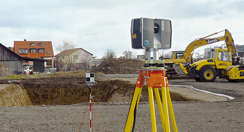
Surveying, as defined by the American Congress on Surveying and Mapping (ACSM), is the science and art of making all essential measurements to determine the relative position of points or physical and cultural details above, on, or beneath the surface of the Earth, and to depict them in a usable form, or to establish the position of points or details.

Through the years, a number of different measurement methods have been used to collect this data. However, as the need for more accurate measurements has evolved, advanced 3D technology has become available to meet existing needs, and provide comprehensive documentation that was not previously possible through traditional methods.
 

白書
建築、エンジニアリング、建設
As-Builtキャプチャとモデリング
建築、エンジニアリング、建設
3Dスキャナー
Focus
測量と測定
認知

ニュースレターを購読して最新情報を入手してください。

関連コンテンツ

フィルタ

フィルタ

VIDEO

Glorious Success: Restoration of the B25 “Sandbar Mitchell” with a FARO Assist

Learn how Michigan’s The Warbirds of Glory Museum uses the FARO® Leap ST to help restore a famous B25 aircraft nicknamed “Sandbar Mitchell.”
ARTICLE

Best Practices for 3D Scan Survey Control with FARO Solutions

Master survey control to enhance accuracy, reduce errors, and boost efficiency in AEC projects with advanced laser scanning techniques.
ARTICLE

Reality Capture Technology: Choosing the Best Solution for You

Explore FARO's reality capture solutions to determine which option aligns with your business goals for the best return on investment.
ARTICLE

Surveying Equipment and Technologies for Accurate Measurement

From traditional land boundary surveys to advanced geospatial mapping, today’s surveying equipment reflects decades of evolution, all aimed at improving accuracy, efficiency, and data integrity.