FARO Sphere® XG Digital Reality Platform
![]()
FARO Sphere XG is a cloud-based digital reality platform that provides its users a centralized, collaborative experience across the company’s reality capture and 3D modeling applications. When paired with the Stream mobile app, Sphere XG enables faster 3D data capture, processing and project management from anywhere in the world.
Sphere XG systematizes every activity while remaining intuitive to navigate, allowing users the ability to better organize their 3D scans and 360° photos alongside 3D models and manage that data across diverse teams around the world.
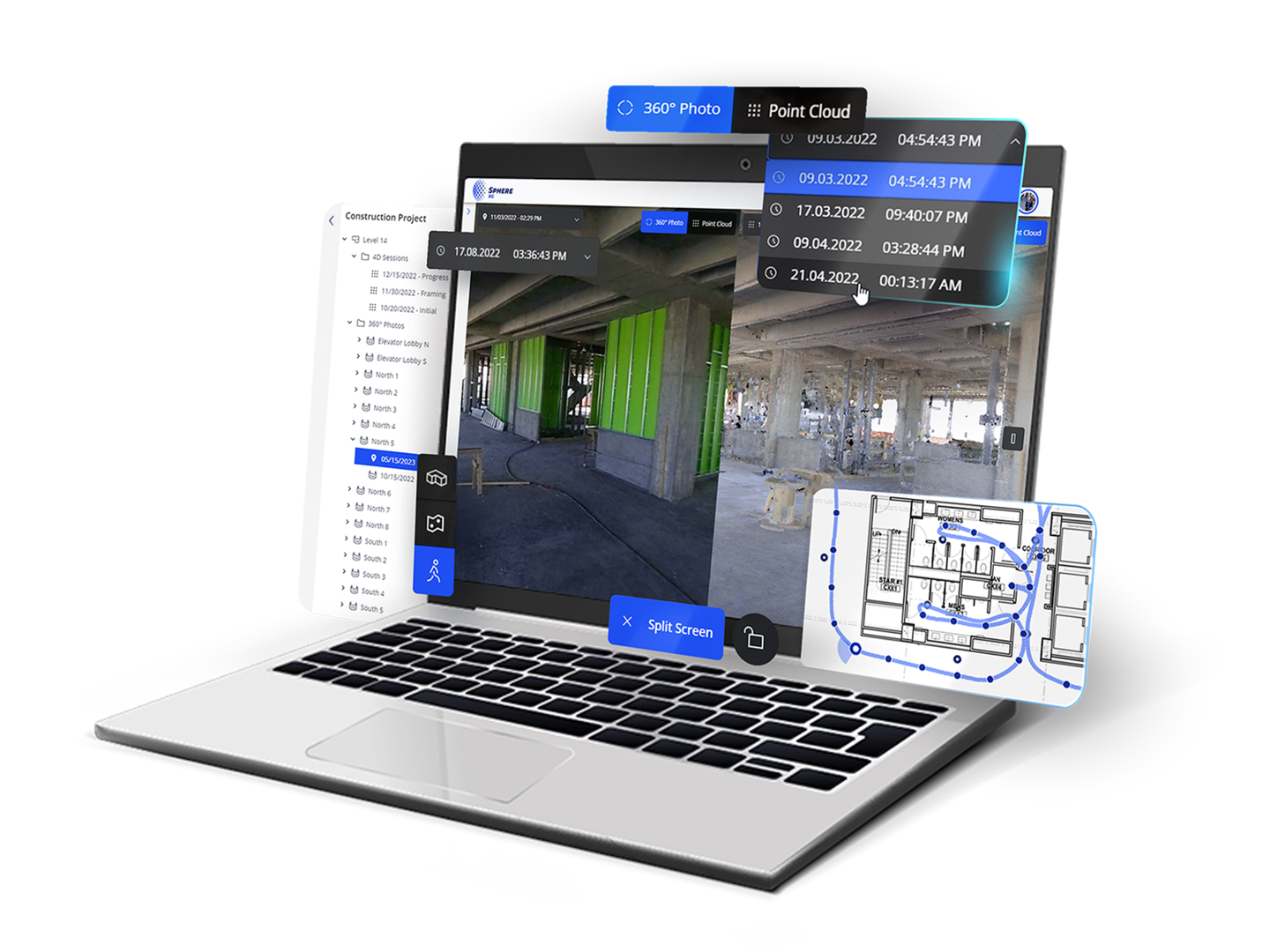
With Sphere XG, 3D point clouds and 360° photo documentation can be viewed and shared all in one place, aligned to a floorplan and viewable over time. Ideal for 4D construction progress management where the ability to compare elements over time is critical, project managers and VDC managers can better democratize data and eliminate the need to use two platforms for their reality capture needs. Now you can import your georeferenced 3D models into Sphere XG and have it aligned effortlessly with your point clouds to track projects and identify potential issues, clashes, or deviations efficiently in one platform. The result is de-siloed data, greater ease of use, and the enhanced ability to share unified, accurate and up-to-date 4D progress documentation in a centralized location.
-
Value
-
Features
-
Apps
-
SOC 2
Sphere XG Features
With Sphere XG, users can:
- Close existing workflow gaps by enabling remote collaboration, project monitoring and completion from anywhere in the world
- Eliminate additional site visits due to registration failure or incomplete scans
- Inform project stakeholders that a scan is complete and that modeling can begin, speeding job completion times yielding significant savings per project
- De-silo data by connecting your point clouds, 360° photos, and 3D models in a single project
Stream Mobile App
For FARO Orbis Mobile Scanner users who wish to upload their scan data into Sphere, the FARO Stream mobile app works in conjunction with the Orbis to enable on-site pre-registration while providing added confidence on the completeness of data capture.
It is common for 3D measurement professionals today to register scan data back on an office computer, off-site. Now, users can perform pre-registration in the field, add annotations and instantly upload on-site data collection to FARO Sphere XG.
FARO Receives SOC 2 Type 2 Report
FARO is committed to delivering the highest standard of information security for our customers. To ensure that we continue to meet this commitment, we have completed a System and Organization Controls 2 (SOC 2®) Type 2 examination of FARO Sphere and HoloBuilder™. Obtaining the internationally recognized SOC 2 Type 2 attestation demonstrates FARO ’s secure organizational posture for optimum safety regarding process monitoring and encryption.
The examination was conducted by A-LIGN, a technology-enabled security and compliance firm trusted by more than 4,000 global organizations to help mitigate cybersecurity risks. The SOC 2 audit testing framework is based off of the Trust Services Criteria (TSC), which are used to identify various risks (points of focus) an organization should consider addressing. Based on the TSCs the organization selects to be in-scope, the third-party compliance and audit firm evaluates whether the organization has the appropriate policies, procedures and controls in place to manage the identified risks effectively.