
Geospatial technology is a collective term for tools that create datasets, like point clouds to map and analyze the earth. These technologies help us to collect data for understanding geographic areas and monitor changes or patterns in landscapes, cities and even societies.
What Does Geospatial Mean?
To understand geospatial technology, we must start with an understanding of the word 'geospatial'. In simple terms, it refers to location-specific data and information related to features on the earth's surface and their geographic area.
So, regarding what ‘geospatial’ means, it's anything relating to a location.
What Is Geospatial Data?
Geospatial data is any data that has a geographic component to it. It can describe features, objects, or even events that have a specific location. Geospatial data will combine information about the location and attributes of an object. Location information can be either dynamic or static.
Various geospatial technologies achieve this type of data collection, like using remote sensing to collect data from a distance. For example, Unmanned Aerial Vehicles (UAVs) gather information quickly and effectively, allowing for the collection of vast amounts of data.
Examples of Geospatial Data
The representation of data is different depending on the geospatial technology chosen to capture it. Here are some examples of geospatial data:
-
Remote Sensing
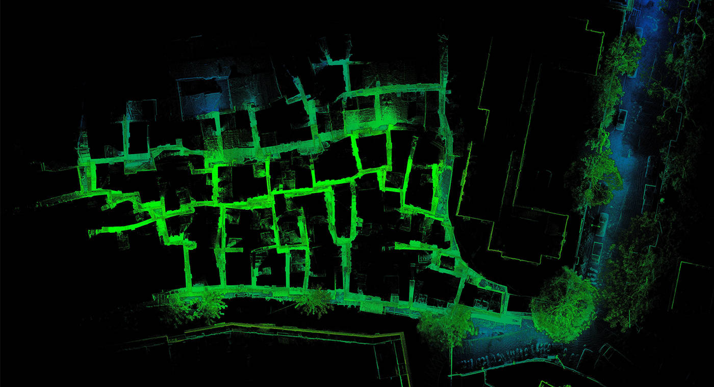
Using remote sensing, laser scanners collect millions of digital data points within an environment. The vast collection of points is known as a point cloud. Each point has a location coordinate and the set of points creates a 3D model of an area or object. The more points in an area, the denser the point cloud and the clearer the 3D representation of the real world. -
Vectors
Vectors consist of points, lines and polygons. Each point has a coordinate, and lines and polygons are formed by connecting them. These elements represent real-world features in any given environment. Each feature has a text or numerical attribute to describe them. -
Satellite Imagery
High-resolution satellite imagery is a type of geospatial data too. Satellites view our world from space, showing us a much larger picture of a geographic area. -
Census Data
When census data links to a geographic area, it becomes a type of geospatial data. For example, city planners will use population data from a census to plan where they might build new roads, schools, or hospitals.
Who Uses Geospatial Data?
There are a host of applications for geospatial data, which means a wide range of groups, companies and people use it. Here are a few examples:
-
Construction
For analyzing potential building sites by providing spatial analysis about terrain, soil types, proximity to infrastructure and environmental considerations. -
Surveying and Mapping
Geospatial data, including LiDAR (Light Detection and Ranging) and satellite imagery aid in the creation of precise site plans and as-built documentation. It is also integrated into BIM to create digital representations of the real world. -
Safety and Risk Management
It is used to identify potential safety hazards and assess risks associated with projects, helping to prevent accidents and ensure compliance with safety regulations. -
Mining and Exploration
The data is utilized in mining exploration through mine planning or mineral mapping. -
Disaster Management
Emergency response agencies use geospatial technology for disaster preparedness, response and recovery efforts, including mapping hazard zones, evacuation routes and resource distribution. -
Transportation and Logistics
Transportation companies use geospatial data for route planning, fleet management and optimizing delivery networks. -
Urban Planning
City planners and developers use data to understand land use patterns, plan infrastructure projects and assess the impact of new developments.
So, What Is Geospatial Technology?
Now you know what geospatial means and what geospatial data is, it's time to consider how this translates into technology. Geospatial technology provides a way to collect and analyze data. It's an umbrella term for the various modern tools and systems that help us to map the earth's surface, understand societies and conduct spatial analysis.
The term 'geospatial technology' is broad and covers a variety of components. Here are some examples of commonly used technologies:
-
LiDAR
LiDAR is a popular method of collecting spatial data using remote sensing. LiDAR emits a laser beam and measures the reflected light return time to the device after hitting a surface. By doing so, LiDAR generates hundreds of thousands of laser beams per second, to create point clouds. -
GPS
The global positioning system (GPS) is a common type of geospatial technology. Satellite data feeds into GPS and is used for global navigation and geolocation. Global positioning systems have been fully operational since 1993 and all modern smartphones contain GPS. -
GIS
Geographic Information Systems (GIS) combine maps with a database of other descriptive information. GIS allow the management and analysis of location information. This type of spatial analysis has provided insight that has changed the way the world works.
Why Is Geospatial Technology Important?
Geospatial technology enables the collection of information, and this data collection is extremely valuable. Using technology to gather location information provides us with data that can give a deeper understanding of many issues. This spatial data can answer questions, and help with predictions, analysis and decision-making.
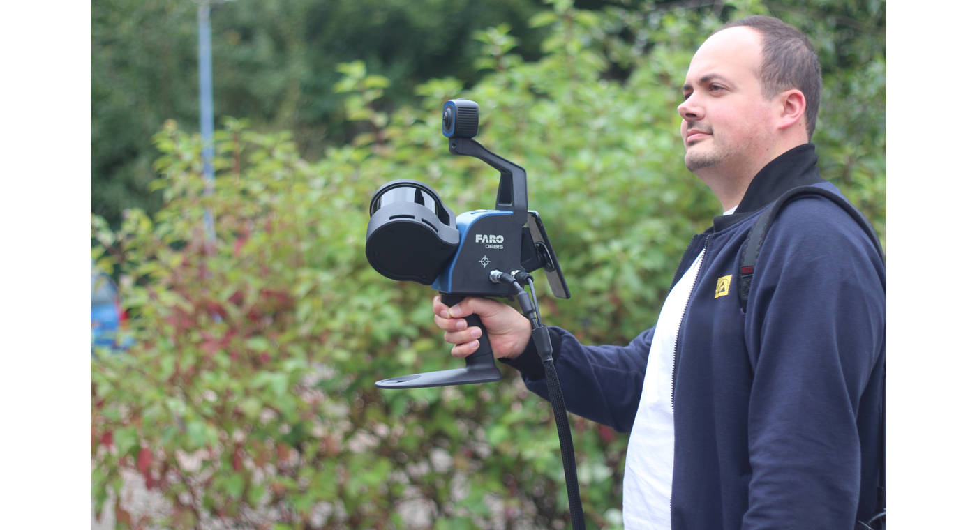
LiDAR products like the FARO® Focus Premium™ or FARO® Orbis™, both powered by Flash™ technology, are already in use capturing geospatial data across various industries. These include:
Architecture, Engineering and Construction (AEC)
In AEC there are many applications for geospatial data. Understanding sites, landscapes and buildings helps large-scale projects run smoothly.
Streamlining Construction Processes
In construction, large teams of people need to work closely together to complete complex projects. This is difficult without access to accurate information about sites, materials and progress. Historically, different data formats left siloes and made it hard for teams to work together. Improvements in geospatial technology and data collection are changing the game for the construction industry because spatial data is objective and works with other data.
Preserving Landmarks
Scanning a large landmark or historical site provides descriptive information about the area. This information is ideal for creating a digital replica of the site and aiding the preservation of heritage areas. Accurately keeping digital records of heritage landmarks or buildings periodically using geospatial technology provides a source of truth for changes over time, whether man-made or natural.
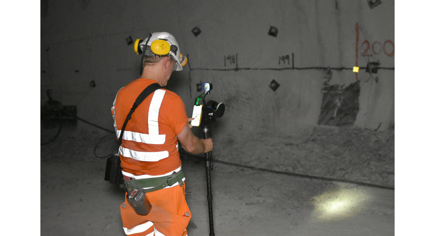
Mining and Underground Scanning
Rapid scanning with LiDAR scanners helps those on-site to map tunnels, stockpile volumes, pits and caves. Often, geospatial technology like LiDAR removes the need for a person to enter a potentially dangerous environment or limits exposure to that environment. With mobile LiDAR, data collection is quick, creating 3D maps to understand, plan and find potential problems to create a much safer working environment.
Public Safety
Police and security personnel also use geospatial data to record evidence or to create evacuation plans for large buildings, such as stadiums and schools, in case of emergency as part of their pre-incident planning.
Geospatial Technology and Data Touches Almost Everything
Without the innovations of geospatial technology, our daily lives could be very different. We often don't fully appreciate how much impact these advances have on the development of spaces, buildings, natural resource management and much more. Geospatial data is vitally important to our world, and we hope we've managed to help you appreciate some of the reasons why.
Gain more insight into the ways FARO Technology works within the Geospatial sector here